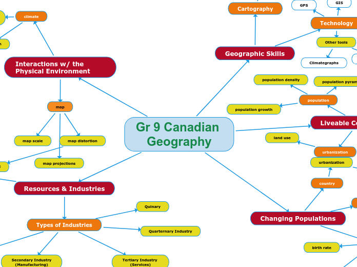
Gr 9 Canadian Geography
Interactions w/ the Physical Environment
map
map scale
map distortion
legend
map projections
climate
perception
natural increases
Resources & Industries
Types of Industries
Primary Industry
(Resource Extraction)
Forestry
Trees
Fishing
Fish
Agriculture
Crops
Livestock
Mining
Ore
Fossil Fuels
Types of mining
Underground
Strip Mining
Open Pit
Secondary Industry
(Manufacturing)
Primary Manufacturing
Logs become boards
Secondary Manufacturing
lumber becomes furniture
Tertiary Industry
(Services)
pharmacy
Subtopic
education
banking
Quarternary Industry
Quinary
Resources
Renewable
hydro
wind
solar
Non-Renewable
co2
fossil fuels
Total Stock
Flow
Changing Populations
people
birth rate
death rate
emigrant
refugee
immigration
aboriginal
life expectancy
country
urbanization
urban sprawl
housing
high density housing
medium density housing
low density housing
Liveable Communities
population
population density
population growth
population pyramids
community
location of customers
recreational
multicultural
residential
urbanization
land use
urban planning
urban land use
Geographic Skills
Cartography
Maps
Elements of a Map
Title
Compass
Legend
Border
Scale
Line
Representative
Fraction
Direct
Statement
Distortion
Projections
Technology
GPS
GIS
Other tools
Population Pyramids
Expanding
Contracting
Stable
Climategraphs
