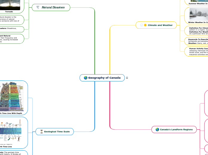
Geography of Canada
Keywords: countries, states, geography, cities, capital city, climate, physiographic divisions
Write the name of the country/state/county you are going to analyze. Then add a representative image.
Geological Time Scale
Think about this general facts about Geography of Canada.
Human Activity Changing The Geological Time Scale: Human activity has changed our planet. We live on every continent and have directly affected 83% of the planet’s land surface. Our influence has impacted everything from the makeup of ecosystems to the geochemistry of Earth, from the atmosphere to the ocean.
Keywords To Describe A Geological Time Scale: Layers, fossilization, pressure, evolution and dinosaurs
Definition Of Geological Time Scale: The geologic time scale is the calendar for events in Earth history. It divides all time into named units of abstract time called descending order of duration eons, eras, periods, epochs, and ages.
Earth Time Line
Earth Time Line With Depth
Natural Disasters
What is the population of Geography of Canada?
Human Activity Causing More Frequent Natural Disasters: Human activity can increase their frequency and intensity. Deforestation is wiping out trees, causing increased risk for flooding, soil erosion, and drought
Keywords To Describe Natural Disasters: Disastrous, tragic, catastrophic, deadly and fatal
Definition Of Natural Disasters: A natural disaster is the negative impact following an actual occurrence of natural hazard in the event that it heavily effects someone with loss of life or damaged property.
Tornado
Volcanic Eruption
The number of people living in Geography of Canada
Canada's Landform Regions
Physiographic regions of the world are a way of defining Earth's landforms into distinct regions.
What are the Physiographic regions of Geography of Canada?
Human Activity Causing Landform Change: Blasting rocks/mountains, digging tunnels, building a dam, cutting down trees for wood.
Keywords To Describe Landforms: Landscapes, topographies, terrains, sceneries and geographies.
Definition Of Landform Region: A landform is a feature on the Earth's surface ( Ex. Mountains, hills, plateaus) that is part of the terrain.
Western Cordillera Region
Map Of All The Landform Regions Of Canada
Climate and Weather
Add geographical features of Geography of Canada. They can be related to the length of the rivers, the height of the mountains, what are the neighbours etc.
Human Activity Causing Climate Change: Burning fossil fuels, releasing chemicals into the atmosphere, reducing the amount of forest cover, and the rapid expansion of farming, development, and industrial activities are releasing carbon dioxide into the atmosphere.
Keywords To Describe Climate: Humidity, predominantly hot, temperate and perpetual tropical. | Keywords To Describe Weather: Rainy, wet, stormy and windless.
Definition For Climate: Climate is the long-term weather pattern in a region, typically averaged over 30 years. | Definition For Weather: The state of the air and atmosphere at a particular time and place.
Winter Weather In Canada
Summer Weather In Canada
Add a geographical feature. It can be related to the length of the rivers, the height of the mountains, what are the neighbours etc.

