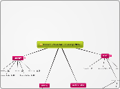
How are Geospatial Technologies Used
Google Earth
Ariel Photography
Who invented Geospatial Technologies
Google
Google Earth was created by Keyhole, Inc, a Central Intelligence Agency (CIA) funded company acquired by
Google in 2004 (see In-Q-Tel).
The Corona Program (Americas First Satellite System) created satellite remote sensing.
Aerial Photography was created by
Gaspar Felix Tournachon in 1858.
The GIS was created by Dr. Roger Tomlinson in the early 1960s
The Global Positioning system was created by Roger Easton.
How to use Google Earth:
Step 1:
Perform searches from the search box at the top left side of the program.
Step 2 :
Drag the map around to move from one area to another.
Step 3:
Utilize the zoom out and zoom in options from the buttons on the right hand side of the screen.
Step 4 :
Turn the wheel in the top right corner to spin the item to a better understood angle.
Step 5:
Change views. To move from an aerial view to a view as if looking from the Earth, use the horizontal bar in the right hand corner.
Step 6:
Look for the date the picture was taken from the bottom left hand corner of the screen.
Step 7:
Utilize the Layers button from the bottom left hand side of the screen.
How to use a GPS
Give a location: A GPS unit accurately triangulates your position by receiving data transmissions from multiple orbiting satellites.
Point-to-point navigation: A location or destination is called a "waypoint." For example, you can establish a starting waypoint at a trailhead by using the location function. If you have the coordinates for the campsite you're headed for (taken from a map, resource book, website, mapping software program or other source), a GPS can give you a straight-line, point-to-point bearing and distance to your destination. Since trails rarely follow a straight line, the GPS' bearing will change as you go. The indicated distance to travel will also decrease as you approach your goal.
"Route" navigation: By combining multiple waypoints on a trail, you can move point-to-point with intermediate bearing and distance guides. Once you reach the first predetermined waypoint, the GPS receiver can automatically point you to the next one or you can manually do this.
Keep a "track:" One of the most useful functions of a GPS unit is its ability to lay a virtual "breadcrumb trail" of where you've been, called a track. This differs from a "route," which details where you're going. You can configure a GPS to automatically drop "trackpoints" over intervals of either time or distance. To retrace your steps, simply follow the GPS bearings back through the sequence of trackpoints.
How to use :
The most common characterization of different satellite remote sensing (RS) systems results from the systems diverse spatial, temporal and spectral resolutions.
The spatial resolution specifies the pixel size of satellite images covering the earth surface.
High spatial resolution: 0.41 - 4 m
Low spatial resolution: 30 - > 1000 m
The temporal resolution specifies the revisiting frequency of a satellite sensor for a specific location.
High temporal resolution: < 24 hours - 3 days
Medium temporal resolution: 4 - 16 days
Low temporal resolution: > 16 days
In the first instance, a sensor's spectral resolution specifies the number of spectral bands in which the sensor can collect reflected radiance. But the number of bands is not the only important aspect of spectral resolution. The position of bands in the electromagnetic spectrum is important, too.
High spectral resolution: - 220 bands
Medium spectral resolution: 3 - 15 bands
Low spectral resolution: - 3 bands
How to use Aerial Photography
Step 1:
Check the law
Step 2:
Find a Drone
Step 3:
Insert the camera into the Drone
Step 4 : Send the drone into the sky and begin taking photos!
How to Use
Step 1:
Acquiring and maintain accurate location data of regulated facilities.
Step 2:
Providing appropriate access to data
Step 3:
Develop a customized map
Step 4:
Provide technical assistance with map
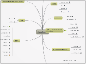
What are the five Geospatial Technologies
Geospatial technology refers to equipment used in visualization, measurement, and analysis of earth's features, typically involving such systems as GPS (global positioning systems), GIS (geographical information systems), and RS (remote sensing).
What careers require the use of Geospatial Technology?
Geospatial Information Scientist
Geospatial Information Scientist
study and analyze how people utilize the physical space around them. They measure and study how the usage of this space changes over time, which helps them determine how things like population, weather and climate conditions, and resources affected these changes.
Softeare Engineer
Software engineers
apply the principles and techniques of computer science,
engineering, and mathematical analysis to the design, development, testing, and evaluation of the
software and the systems that enable computers to perform their many applications.
Professional Photogrammetrist,
The Photogrammetrist is responsible for all phases of mapping and other mensuration requirements, which include planning and supervising survey activities for control, specifying photography or other imagery requirements, managing projects for mapping or other mensuration requirements and interpretation.
Geospatial Engineer
Geospatial engineers are responsible for using geographic data that supports military/civilian operations for Disaster Relief and Homeland Security. They collect, analyze and distribute geospatial information to represent the terrain and its possible effects.
Geospatial Analyst
A geospatial analyst collects and analyzes the real-time geographic positioning information from global positioning systems (GPS) information and raw data collected from positioning satellites.
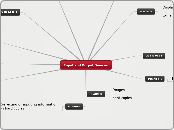
What is the purpose for Geospatial Technologies?
Report
Accquire
Process
Google Earth
a virtual globe, map and geographical information program that was originally called EarthViewer 3D created by Keyhole, Inc, a Central Intelligence Agency (CIA) funded company .
Global Positioning System
a satellite-based navigation system made up of a network of 24 satellites placed into orbit by the U.S. Department of Defense.
GPS was originally intended for military applications, but in the 1980s, the government made the system available for civilian use.
Satellite Remote Sensing
the technology of acquiring information about the earth's surface (land and ocean) and atmosphere using
sensorsonboard airborne (aircraft, balloons) or spaceborne (
satellites, space shuttles) platforms.
Aerial Photography
is the taking of
photographs of the ground from an elevated position. Usually the camera is not supported by a ground-based structure.
Geographic Information System
a computer
system that allows you to map, model, query, and analyze large quantities of data within a single database according to their location. GIS gives you the power to: create maps.
Geospatial Technologies
The equipment used in visualization, measurement, and analysis of earth's features


