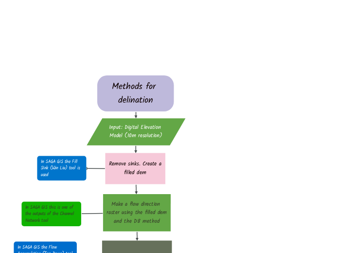
In SAGA GIS the interactive Upslope Area tool
This is the case for this lab report. There are three points; the two outlets and the guage
In SAGA GIS the Channel Network toool is used
In SAGA GIS this is one of the outputs of the Channel Network tool
In SAGA GIS vectorize the watershed raster
In SAGA GIS the Flow Accumulation (Top-Down) tool is used which takes the depression voided DEM as input
In SAGA GIS the Fill SInk (Win Liu) tool is used
In this case, through trial and error, a value of 550,000 is used because its output appears to match the real streams adequately.
Derive a watershed for each point
Modify the watershed as need
Done
Methods for delination
Input: Digital Elevation Model (10m resolution)
Remove sinks. Create a filled dem
Make a flow direction raster using the filled dem and the D8 method
Make a flow accumulation raster
Make a stream network based on a chosen initiation threshold.
Are pour points provided?
True
Create a stream link raster
Derive a watershed for each stream section
