SPATIAL DISTRIBUTION OF POPULATIONS
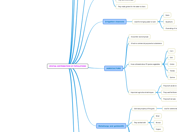
The Inca Empire was a highly organized society with complex territorial and social structures. Its economy was primarily agrarian, with sophisticated agricultural techniques such as terrace farming, canal construction, and the use of fertilizers to support subsistence farming.
Megnyitás
SPATIAL DISTRIBUTION OF POPULATIONS Textiles The manufacture process Dyeing Yarn Fiber They were defined by geometric shapes The Chacana symbolizes The four “suyos”, from the Tahuantinsuyo. They express the thought Manufacture Form of geometric designs Circles Triangles Rhombus Bars Characteristics of ceramics tones and cuttlefish Red Black White Orange Purple Characterized by mass and standardized production Metallurgy and goldsmith They did riverbank mining Used techniques to shaping and molds for complex objects. They worked with Copper. Bronze Silver Gold was property of the gods was for ceremonial use AGRICULTURE Important agricultural techniques They built terraces They used fertilizers They built canals to carried the water to the platforms Incas cultivated about 70 species vegetables Quinoa Tomato Cotton Chili Corn It had no commercial purpose but subsistence It was their economy base Irrigation channels Used for bringing water to land Channeling of rivers Aqueducts Dams Roads They made gutters for the water to drain. They built a stone base Is several meters wide and thousands of kilometers long. System Capac Ñan Bridges They built five models of bridges Floating bridges Oroya Of stones Of logs Pendants Engineering Important sample of this development Machu Picchu Cusco (in present-day Peru) Technologies adapted to the environment Land distribution Divided into The lands of the Town Lands of the Inca Lands of the Sun No private property existed Monarchical and paternalistic Ayllus The Inca Empire was made up for four sucers of its lineage An old man lead the community Suyoyuc Apu The core of the Inca Empire Territorial structure Social structure
