製品
Mind Mapping Software
Outlining Software
ガントチャートソフトウェア
用途
教育向けマインドマップ
ビジネス向けのマインドマップ
個人的な開発のためのマインドマップ
マインドマッピングの利点
リソース
特徴
教育
個人と仕事
デスクトップ
Video Tutorials
Watch tips and tricks about using Mindomo.
Help Center
Detailed help guide on configuring and using Mindomo.
記事
Top 29 Mind Map Examples
Gantt Chart Software
Concept Map Template
Free mind map software
What is a concept map?
Gantt Chart Maker
Mind Map App
Concept Map Maker
Mind map template
価格
ログイン
登録
製品
Mind Mapping Software
Outlining Software
ガントチャートソフトウェア
用途
教育向けマインドマップ
ビジネス向けのマインドマップ
個人的な開発のためのマインドマップ
マインドマッピングの利点
リソース
ブログ
Video Tutorials
Help Center
マインドマッピングとは何ですか?
オンラインでマインドマップを作成する
コンセプトマップメーカー
記事
Top 29 Mind Map Examples
Gantt Chart Software
Concept Map Template
Free mind map software
What is a concept map?
Gantt Chart Maker
Mind Map App
Concept Map Maker
Mind map template
特徴
教育
個人と仕事
デスクトップ
価格
登録
ログイン
カテゴリー
全て
-
mountains
-
geography
-
climate
-
tectonics
によって
Elizabeth Kaplun
1年前.
108
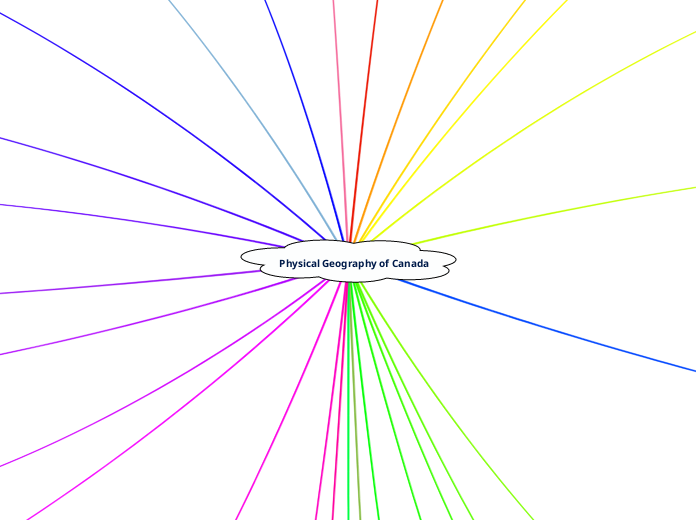
Physical Geography of Canada
Canada's physical geography significantly influences its diverse climate patterns and ecosystems. Proximity to water bodies creates maritime climates with moderate temperatures, while continental regions experience more extreme weather.
開く
もっと見る
Grade 7 Ancient Civilizations
Andrew Smithにより
Background Information of The Kite Runner
Sun Choiにより
Democracy Mrs. Robin Spring 2024
Malia Robinにより
SS 5 Themes of Geography Research Paper
Graham Lynchにより
Physical Geography of Canada
Wind
Tundra
lichens
moss
permafrost
Elevation
Soil
Organic Matter
Air
Water
Minerals
magnesium
calcium
iron
Grasslands
south
long grass prarie
north
short grass prarie
Affect on Climate
Continental → Away from water, extreme temperatures
Maritime → Near water, moderate temperatures
Earths Layers
Glaciation
Oak Ridges Moraine
Water runoff feeds over 30 major waterways in Ontario
160 km long and 3 km - 24 km wide
Formed by two glaciers pushing rock, sand, clay, and gravel together
Tectonic Faulting
Transform ( Strike-Slip )
Convergent ( Reverse )
Divergent ( Normal )
Tectonic Plates
Transform
Divergent
Convergent
Polar bears
Earth in space
Seasons
Rotation Vs Revolution
Creation in space
Science based
Big Bang Theory
Tradition / Spiritual
Turtle Island
Religious
Wet lands
Geological Era's
Mesozoic
Paleozoic
Cenozoic
Precambrian
Worms
Latitude
Further from equator → Colder climate
Closer to equator → Warmer climate
Coniferous
grows quickly
pine, spruce
Beavers
Calcification
CONNECTIONS
Polar bears and Ice caps and Humans
Golden eagles and Scottish HIghlands
Banff National Park and Grizzly Bear
Tsunami and Plate Tectonics
Canadian Shield and Plate tectonics
Geese and Grass
Bison and Grasslands
Birds and Wind
Trees and Humans
Wetlands and turtles
Ocean Currents and Whales
Beavers and Deciduous trees
Snow Leopards and glaciers
Polar bears and Tundra
Crust and sediment
Yoho National park, glaciers and elevation
Owls and Grasslands
Worms and Soil
Ocean Currents
Cold currents → Cool, dry air
Warm currents → Warm, moist air
Fold Mountains
Inactive
Atlas mountains (Morocco)
Scottish highlands
Appalachians (North America)
Active
Alps (Europe)
Andes (South America)
Himalayas (Asia)
Rockies (North America)
Relief Precipitation
High elevation opposite water → rain shadow (less precipitation)
High elevation near water → Increased precipitation
Lanform Regions
National Parks
Rock cycle
Metamorphic
Sedimentary
Igneous