av jina zgn 6 år siden
301
mind map
Canada's physical geography encompasses diverse landform regions, including the Arctic Lowlands, Western Cordillera, Hudson Bay Lowlands, and the Canadian Shield. Its climate systems are influenced by factors such as latitude, elevation, and proximity to water bodies, resulting in varied conditions across the country.
Åpne
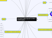
physical geography of Canada climate regions atlantic maritime south eastern prarie boreal pacific maeitime cordilleran talga artic vegetation treeline tundra praire grassland coniferous delciduous natural disaster hurricane eartquakes tsunamis tornadoes hurricanes ring of fire classification of clouds stratus nimbostratus cumulus stratocumulus atocumulus atoostratus cumulonimbus cirrostatus cirrocumulus cirrus eras Hadean Proterozoic earths physical process mountain building earths plate & volcanos tectonic plates erosion hydraulic action attrition abrasion mountain building land slides pyroclastic ice ages glaciation earths layers inner core outer core mantle atphosphere lithosphere crust volcanoes pyroclastic cloud flying debris landslide lava flow landform regions Innuitian Mountains Arctic Lowlands Appalachian Great Lakes-St. Lawrence Lowlands Hudson Bay Lowlands Canadian Shield Interior Plains Western Cordillera canada's climate systems humans near water relief parecipitation elevations colder wind ocean currents latitude geologic time geologic time in % earths life human life soil ingredient decomposing organic matter air minerals water rock cycle magma metamorphic rock Subtopic sedimentary rock sediment ingenious rock big creation religious creation successive universe turtle island national parks Jasper National Park Zion National Park Yosemite Yellowstone National Park Georgian Bay Islands National Park Banff National Park


