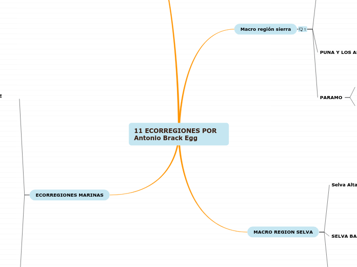
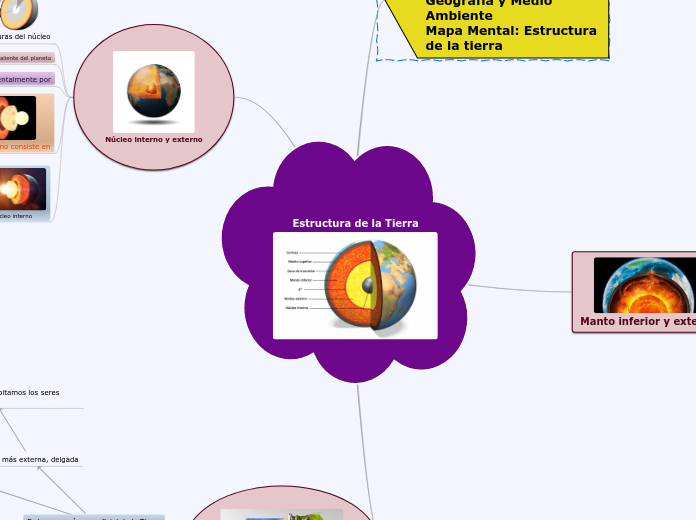
11 ECORREGIONES POR Antonio Brack Egg
Rivers have always been essential for human life and settlement. A source for drinking, the source of food, and a way to transfer goods from one place to another. They are essential in the environment of rainforest and wetlands.
ECORREGIONES MARINAS
The Yangtze holds the title of Asia’s longest river. The Yangtze has a momentous place in China’s history and culture, providing some of the country’s most fertile land as well as some of its most artistically inspiring scenery.
Where the Mekong river runs, the land is incredibly verdant shaping one of the richest areas of biodiversity on the planet. Thousands of species call its shores and waters home. Long an essential trade route the Mekong passes through, or close to, some of the region’s most important cities, including Vientiane, Phnom Penh and Saigon.
MAR TROPICAL
The Mekong is a trans-boundary river in Southeast Asia. Its estimated length is 4,350 km.
From the Tibetan Plateau, the river runs through China's Yunnan Province, Myanmar, Laos, Thailand, Cambodia, and Vietnam.
The Mekong rises as the Za Qu and soon becomes known as the Lancang (Lantsang) in the 'Three Rivers Source Area' on the Tibetan Plateau in the Sanjiangyuan National Nature Reserve. It approaches and empties into the sea through the Mekong Delta. Tributaries: Nam Khan, Tha, Nam Ou, Mun, Tonle Sap, Kok, Ruak.
Su simbolo
The Mekong basin is one of the richest areas of biodiversity in the world which is only surpassed by the Amazon?
Search for other interesting facts about this river and add them here.
El cocodrilo americano o de Tumbes
EMPLAZAMIENTO
Mekong River has many tributaries. Type in at least 3 of its affluents.
Zona de los manglares
Fauna
Cangrejos
Langostinos
Conchas negras
Sede en las orillas del mar
Marea sube
Ingresan a los manglares las especies marinas
Marea baja
Los animales terrestres van en busca de alimentos
Where is the place where Mekong drains into a larger body of water ? Type in the answer.
Aves
Ave del trópico
Ave fragata
Paloma de cabo
Petrel gigante
Peces
Barrillete
Merlín negro
Atún de aleta amarilla
Peces voladores
Bonito
Tiburón
CARACTERISTICAS
Where is the original point from which Mekong flows? Type in the answer.
No tiene oxigeno por las temperaturas tropicales
No hay afloramiento
No es rico en nutrientes
CORRIENTE DE "EL NIÑO"
Tiene influencia crucial en esta ecorregión
Mekong River flows through 6 countries. Type them in.
5° de latitud al sur de Piura hasta el sur de California en los Estados Unidos
MAR FRÍO DE LA CORRIENTE PERUANA O HUMBOLDT
The Yangtze or Yangzi is the longest river in Asia and the longest in the world to flow entirely within one country (Qinghai, Tibet, Yunnan, Sichuan, Chongqing, Hubei, Hunan, Jiangxi, Anhui, Jiangsu, Shanghai provinces). It rises in the northern part of the Tibetan Plateau and flows 6,300 km in a generally easterly direction to the East China Sea.
Tributaries: Yalong, Min, Tuo, Jialing, Han, Wu, Yuan, Zi, Xiang, Gan, Huangpu.
In mid-2014, the Chinese government announced it was building a multi-tier transport network, comprising railways, roads, and airports, to create a new economic belt alongside the river.
Where is the place where Yangtze drains into a larger body of water ? Type in the answer.
Abundancia en plactón
Where is the original point from which Yangtze flows? Type in the answer.
AVES
Pelicano peruano
Potoyunco
Brujilla
Zarcillo
Piquero
La chuita
El guanay
Pinguino de Humboldt
MARINA
Gatos Marinos
Lobos
Cachalotes
Ballenas
26 especies de delfines
600 especies de peces
Anchoveta
Sardina
FENOMENO CARACTERISTICO
"Afloramiento de las aguas"
Se produce en la extensión de 1500Km de largo y 6okm e ancho
TEMPERATURA
Verano
15°-17°
Iniverno
13°-14°
UBICACIÓN
Yangtze River flows through 9 provinces in China. Type at least 5 of them.
Centro de Chile hasta los 5° e latitud sur en Perú
Europe
The Volga is the longest river in Europe. The waters of the Volga are used to irrigate the steppe regions of southern Russia. Because of its importance in the country, the Volga has mythological status in Russia, and many iconic sites are found along its banks
The Danube is the second-longest river in Europe. Travelers can experience many of the river's sights by embarking on a cruise along its waterways. Danube River Cruises, which are offered by Viking Cruises, typically stop in Cologne, Budapest, Nuremberg, Belgrade and Krems. Following the river is a way to experience several Eastern European cities in one trip. Famous monuments, such as the Hungarian Parliament, have been erected on its coast.
Danube
The Danube is located in Central and Eastern Europe.
The Danube flows through 10 countries, more than any other river in the world. Originating in the Black Forest in Germany, the Danube flows southeast for 2,850 km, passing through or bordering Austria, Slovakia, Hungary, Croatia, Serbia, Romania, Bulgaria, Moldova and Ukraine before draining into the Black Sea. The mouth of the Danube is the Danube Delta. The greater part of the Danube Delta lies in Romania, with a small part in Ukraine (Odessa Oblast).
Tributaries :Iller, Lech, Altmühl, Naab, Regen, Isar, Inn, Ilz, Enns, Morava, Rába, Váh, Hron, Ipeľ, Sió, Dráva, Vuka, Tisza, Sava, Tamiš, Great Morava, Mlava, Karaş, Jiu, Iskar, Olt, Osam, Argeș, Ialomița, Siret, Prut.
The Danube is the source of drinking water for almost 10 million people?
Search for other interesting facts about this river and add them here.
Danube has over 27 tributaries. Remember that a tributary is a stream or river that flows into and joins a main river. Type in the names of some of Danube's tributaries.
This is the place where Danube drains into a larger body of water . Type in the answer.
Mouth of Danube River
Remember that this is the original point from which the river flows. Type in the answer.
Where is the Danube's source?
Type in Danube's length.
Which countries does the Danube flow through?
Danube River flows through 9 countries in Europe. Type them in.
Country
Volga
The Volga is the longest river in Europe with a catchment area of 1,350,000 square km.
Eleven of the twenty largest cities of Russia, including the capital, Moscow, are located in the Volga's drainage basin. Rising in the Valdai Hills 225 meters above sea level northwest of Moscow and about 320 km southeast of Saint Petersburg, the Volga heads east past Lake Sterzh, Tver, Dubna, Rybinsk, Yaroslavl, Nizhny Novgorod, and Kazan. From there it turns south, flows past Ulyanovsk, Tolyatti, Samara, Saratov, and Volgograd, and discharges into the Caspian Sea.
Tributaries: Kama, Oka, Vetluga, and Sura. The Volga Delta has a length of about 160 kilometers and includes as many as 500 channels and smaller rivers.
Did you know?
The Volga freezes for most of its length during three months each year.
Search for other interesting facts about this river and add them here.
Tributaries
Volga River has 23 main tributaries. Type in several examples.
Tributary
Mouth
This is the place where it drains into a larger body of water - another river, a lake, the sea or the ocean.
Where is the mouth of the Volga River?
Source
The source of a river, also called headwaters, is the original point from which the river flows. Type in Volga's source.
Source of Volga River
Length
Length of Volga River
Which cities does the Volga flow through?
Volga flows through 11 out of the 20 most important cities in Russia. Type in a couple of these cities.
City
MACRO REGION SELVA
There are four major rivers in Africa: the Nile, the Zambezi, the Congo, and the Niger. The Nile is one of the longest rivers in the world.
The Zambezi's most noted feature is Victoria Falls. Other notable falls include the Chavuma Falls at the border between Zambia and Angola, and Ngonye Falls, near Sioma in Western Zambia.
150 especies de mamíferos. En los ríos abundan los hogares de delfines boto o amazónico, que es famoso por ser un mamífero cetáceo adaptado a la vida selvática.
1.500 especies de plantas en las zonas más llanas y planas, pero existen alrededor de 5.000 tipos de plantas diferentes en los bosques
20° y 27° C., aunque algunas veces durante el día puede llegar hasta los 37°
SELVA BAJA
The Zambezi is the fourth-longest river in Africa and the largest flowing into the Indian Ocean from Africa. The area of its basin is 1,390,000 square km.
The 2,574-km-long river rises in Zambia and flows through eastern Angola, along the north-eastern border of Namibia and the northern border of Botswana, then along the border between Zambia and Zimbabwe to Mozambique, where it crosses the country to empty into the Indian Ocean.
Major tributaries: Chifumage River, Luena River, Kabompo River, Lungwebungu River, Luanginga River, Gwayi River, Sengwa River, Sanyati River, Kafue River, Luangwa River, Panhane River, Luia River.
Where is the original point from which Zambezi flows? Type in the answer.
600 especies. De estas especies la más importante es el paiche
2,550 especies de árboles. De esta inmensa variedad de flora las más importantes especies son la Caoba, Aguaje, Cebolla, Oje, Chonta; además del Tamshi, Shiringa, Ayahuasca
Zambezi River flows through 6 countries and 1 republic from Africa. Type them in.
24 °C aproximadamente.
Selva Alta o Rupa-Rupa
The Nile, which is about 6,650 km long, covers eleven countries: Tanzania, Uganda, Rwanda, Burundi, the Democratic Republic of the Congo, Kenya, Ethiopia, Eritrea, South Sudan, Republic of the Sudan and Egypt.
It has two major tributaries, the White Nile and the Blue Nile. The White Nile is the headwaters and primary stream of the Nile. The White Nile is longer and rises in the Great Lakes region of central Africa, with the most distant source still undetermined but located in either Rwanda or Burundi. The two rivers meet just north of the Sudanese capital of Khartoum.
The northern section of the river flows north almost entirely through the Sudanese desert to Egypt, then ends in a large delta and flows into the Mediterranean Sea.
Remember that the source of a river is the original point from which the river flows. There are different types of sources: lake, marsh, spring or glacier.
Type in the Nile's source.
caucho, palmeras aceiteras, orquídeas, bombonaje, cabuya, molle, romerillo, higuerón, roble, cacao, arrayán, catahua, achihua, etc. Los tipos de cactus que más representa la selva alta es el sugaro y la tuna.
En el caso de la fauna tenemos a la sachavaca (es un mamífero de mayor tamaño de la región) shushupe, paujil, gallito de las rocas, páucar, etc.
The Nile flows through 7 countries and 3 republics from Africa. Type them in.
Clima semicálido muy húmedo entre 2500 y 600 m s. n. m., con precipitaciones elevadas y temperatura promedio de 22º C.
Macro región sierra
North America
In the 18th century, the river was the primary western boundary of the young United States, and since the country's expansion westward, the Mississippi River has been widely considered a convenient dividing line between the Eastern, Southern, Midwestern United States, and the Western United States.
South America
Amazon River, the greatest river of South America and the largest drainage system in the world in terms of the volume of its flow and the area of its basin.
Las 11 ecorregiones se dividen en 4 macro regiones que engloba a la totalidad de estas .
PARAMO
Main tributaries - Marañón, Napo, Japurá/Caquetá, Rio Negro/Guainía, Putumayo, Trombetas, Ucayali, Javary, Juruá, Purús, Madeira, Tapajós, Xingu.
The Amazon and its tributaries flow through the countries of Peru, Bolivia, Venezuela, Colombia, Ecuador, and Brazil before emptying into the Atlantic Ocean 6, 437 km (4,000 miles) from the Amazon's headwaters high in the Andes mountains of Peru.
FUNA
Although the Amazon is such an enormous river, there are no bridges to cross the river along its entire length?
Search for other interesting facts about this river and add them here.
Colombia, a 30 km de la capital Bogotá. Se trata de Sumapaz y cuenta con una extensión total de 333.420 Ha (3334 km²) de las cuales sólo 142.112 Ha
Try to state the length either in miles or in kilometers.
Las 11 ecorregiones se dividen en 4 macro regiones que engloba a la totalidad de estas
Cordillera de Mérida en Venezuela, pasando por Colombia y Ecuador hasta el norte del Perú en la denominada depresión de Huancabamba.
PUNA Y LOS ALTOS ANDES
puna es un ecosistema altitudinal que se desarrolla desde las orillas de los lagos (3600-3800 msnm) hasta una altitud aproximada de 4400 msnm
cuy, la chinchilla altiplánica, las vizcachas serranas, la taruka o ciervo de altura, el venado gris
clima templado de altura y en los pisos altos clima alpino, similar al clima de tundra polar. La puna tiene elevada sequedad atmosférica, es algo cálida de día y bastante fría en la noche.
SERRANIA ESTEPARIA
Its source is Lake Itasca in northern Minnesota and it flows generally south for 2,320 miles (3,730 km) to the Mississippi River Delta in the Gulf of Mexico.
The main stem is entirely within the United States. Tributaries - St. Croix River, Wisconsin River, Rock River, Illinois River, Kaskaskia River, Ohio River, Minnesota River, Des Moines River, Missouri River, White River, Arkansas River.
The river either borders or passes through the states of Minnesota, Wisconsin, Iowa, Illinois, Missouri, Kentucky, Tennessee, Arkansas, Mississippi, and Louisiana.
ESTEPA ALTA
gramíneas, pajonales y arbustos diversos, especialmente el tarwi o chocho.
ESTEPA MEDIA
bosques ralos y zonas peñascosas cubiertas de bromelias y cactáceas.
ESTEPA BAJA
árboles como el mito, arbustos como el huanarpo, cactáceas y bromeliáceas.
SEMIDESIERTO
achupallas, cactáceas, gramíneas y árboles como el huarango.
FLORA
A tributary, also called an affluent, is a stream or river that flows into and joins a main river. The place where the tributary and the main river meet is called a confluence.
Name as much tributaries as you can.
vegetación xerófita de suculentas como las cactáceas espinosas y las bromeliáceas
FAUNA
The mouth of a river refers to the end of a river, the place where it drains into a larger body of water - another river, a lake, the sea or the ocean.
puma, venado gris; auquénidos, gato montés, vizcacha, zorrino o añás y zorro andino
CLIMA
The source of a river, also called headwaters, is the original point from which the river flows. There are different types of sources: lake, marsh, spring or glacier.
20 °C a 0 °C
