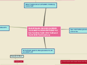
EUROPEAN DISCOVERIES AND INVENTIONS in the 15th and 16th century
What made exploration possible?
Ships
Naos
Larger ships at end of 15th century
Caravels
Small fast ships maneuverable
Navigation tools
The tables of the Almana Perpetuum
Astronomical tables that helped with celestial navigation
Published in 1446 by Abraham Zacuto
First globe
Only accurate way to study the earth because it correctly represents the shape of it
Invented in 1492 by Martin Behaim
Mercator projections
A cylindrical map that really helped the navigators thanks to the lines of longitude and latitude
Invented in 1569 by Gerardus Mercator
Portuguese explorers and discoveries
Ferdinando Magellano
He organised the Spanish expedition to the East Indies from 1519 to 1522, resulting in the first circumnavigation of the Earth, completed by Juan Sebastián Elcano.
Bartolomeu Dias
He sailed around the southernmost tip of Africa in 1488, the first to do so, setting up the route from Europe to Asia later on
Vasco da Gama
Between 1497 and 1499 he reached India for the first time and his discovery was significant and opened the way for an age of global imperialism and for the Portuguese to establish a long-lasting colonial empire in Asia
Prince Henry
(NOT AN EXPLORER) Between 1425 and 1460 Prince Henry the Navigator trained Portuguese sailors to go exploring
What motivated the explorers?
Confidence and arrogance
Belief in superiority of Christianity
Control of new lands and people
Leaders of voyages were promised riches and aristocratic titles
Desire and opportunity to get rich
They wanted silk from China
They wanted gold from Africa
The wanted jewels form India
Spanish explorers and discoveries
Amerigo Vespucci
He first demonstrated in 1502 that Brazil and the West Indies did not represent Asia's eastern outskirts but instead constituted an entirely separate landmass. Colloquially referred to as the New World, it came to be termed "the Americas", a name derived from Americus, the Latin version of Vespucci's first name
Francisco Pizarro
In 1513 he discovered the Pacific Ocean and in 1533, inspired by Cortés, he conquested the Incan empire in Perú
Hernan Cortés
In 1519 he landed on the coast of Mexico and defeated the Aztecs inspiring other conquistadores
Christopher Columbus
He arrived in the Carribean in 1492 and opened the Americas to later European explorers
