Unit 2 Physical Processes
The Rock cycle
Different uses of rock
Granite- buildings, statues, countertops etc.
Crystals such as diamond and amethyst are used in jewellery and industrial cutting
Bulk/Quarry stones are used in construction & landscaping
Rock Containing Minerals- Aluminum, Copper, Gold, Tin and other precious metals
Sandstone- Building materials
Coal & Bitumen: Fossil Fuels provide the energy to heat our homes, propel our cars, planes and boats etc.
Gypsum- Drywall in homes
Limestone- Aggregates for
road construction
Potash- Fertilizers
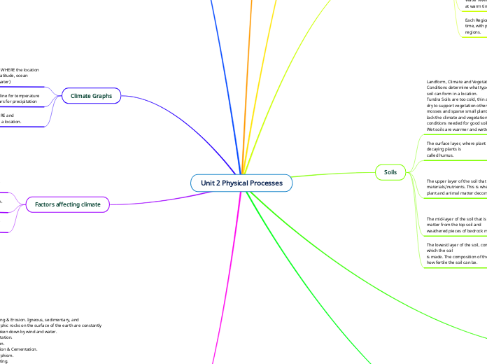
Weathering & Erosion. Igneous, sedimentary, and metamorphic rocks on the surface of the earth are constantly being broken down by wind and water.
Transportation.
Deposition.
Compaction & Cementation.
Metamorphism.
Rock Melting.
Factors affecting climate
The amount of sunlight a location receives will determine the average temperature.
Climate is the long term weather trends in a particular region. (tropical, polar, seasonal norms)
Weather is the current atmospheric conditions. (rainy, sunny, windy, cold, warm etc)
Climate Graphs
Climate is the combination of TEMPERATURE and PRECIPITATION conditions experienced at a location.
A climate graph has 2 parts: A red line for temperature
Blue bars for precipitation
The shape of the graph tells us a lot about WHERE the location is with reference to the 6 climate factors (latitude, ocean currents, wind, elevation, relief and near water)
Natural Hazards and Disasters
Different types of Natural Disasters and Hazards
Hurricanes: Powerful tropical storms formed from hot ocean waters and winds. Characterized by destructive winds, heavy rain and storm surge flooding
Avalanches: The rapid downhill movement of a slab of snow
Floods:
When too much rain or snowmelt occurs in a short time, rivers, lakes and land can be inundated.
Wildfires:
Prolonged drought conditions create areas of dry vegetation easily ignited.
Tsunamis:
When an earthquake occurs underwater, large waves are created that flood nearby coastal areas
Volcanoes:
When magma escapes through the earth’s crust.
Occurs at plate boundaries and hotspots.
Tornadoes:
Occurs where warm moist air and cold air meet, making the atmosphere unstable.
Drought:
A period of below-average precipitation. Causes water shortages and crop failure.
Landslides:
Mass movements of rock, mud, and debris downhill.
Occur in steep or mountainous areas with heavy precipitation
Earthquakes:
When tectonic plates shift energy is released as destructive seismic waves.
Most common at plate boundaries.
Physical Geography and its impacts on the Earth
Formation of the Arctic:
The arctic is a diverse landscape with MOUNTAINS, LOWLANDS and areas of CANADIAN SHIELD. Because of this diversity we describe it as forming over a long period of time and is still forming today!
Formation of Canadian Shield
540+ million years ago
The eruption of VOLCANOES continued for hundreds of millions of years creating huge mounds of IGNEOUS and METAMORPHIC rock known as a shield. The CANADIAN SHIELD was a barren landscape that became the North American continent. During this time the Canadian Shield was huge VOLCANIC MOUNTAIN RANGES.
Over the past 540 million years, WEATHERING and EROSION by water and GLACIERS have worn down these mountains into ROCKY HILLS. On both sides of the Can. Shield, SEDIMENT compacted into SEDIMENTARY rock at the bottom of shallow seas.
Formation of Hudson Bay Lowlands and Great Lakes St. Lawrence Lowlands
During the last 1 million years, Canada was covered by CONTINENTAL GLACIERS that WEATHERED and ERODED our landscape heavily. As these glaciers SCRAPED across the surface, they CARVED away soil and rocks leaving a low lying landscape of older SEDIMENTARY ROCK. When they melted away, the glacial water filled the lowest areas creating many lakes (including the Great Lakes) that drain through the St. Lawrence River out to the Atlantic Ocean.
Forming of the Earth
The Earth formed 4.6 billion years ago when a large number of smaller space rocks collided into each other forming a very hot ball of melted rock.
At this time, even the surface of the Earth was too hot for MAGMA/LAVA to cool. Over time the surface cooled and formed a thin layer known as the CRUST made of IGNEOUS rock. The heat still present from the earth’s formation erupted from the crust creating large VOLCANOES and lots of IGNEOUS rock.
Vegetation Regions
VEGETATION: plants considered collectively, especially those found in a particular area or habitat.
Landforms and Climate impact what species of plants can grow in an area.
Being near water increased rainfall amounts
Being near water lowers the range of temperatures throughout the year.
Mountains create climates that are wet, dry, warm and cold
Soils
The lowest layer of the soil, containing the rock material from which the soil
is made. The composition of the parent material will determine how fertile the soil can be.
The mid-layer of the soil that is a combination of organic matter from the top soil and
weathered pieces of bedrock material from below.
The upper layer of the soil that is rich in organic materials/nutrients. This is where
plant and animal matter decomposes, creating new topsoil.
Soil Interrelationships
Fertile soils exist in areas where the right combination of GEOLOGY, CLIMATE
and VEGETATION are found. Using the information above, describe how the
regional conditions of the above factors can influence soil for better or worse
(create great soils or lead to poor soils).
The surface layer, where plant material grows. The layer of decaying plants is
called humus.
Landform, Climate and Vegetation
Conditions determine what type of
soil can form in a location.
Tundra Soils are too cold, thin and
dry to support vegetation other than
mosses and sparse small plants. They
lack the climate and vegetation
conditions needed for good soil.
Wet soils are warmer and wetter
Landform Regions
Each Region of Canada’s landscape formed at a particular time, with particular processes, leaving distinct and unique regions.
Water levels rise and fall with changing climate creating seas at warm times and evaporating away during cooler times.
Glaciers advance and retreat with a changing climate; weathering, eroding and depositing sediment
Mountains weather and erode into smaller hills.
Tectonic plates collide to build mountains and diverge into oceans.
Canada covers a huge part of the Earth’s surface and looks quite different depending on where you happen to be. Canada is divided into 7 unique regions based on the physical processes that shaped that location over the past 4.6 billion years!
Plate tectonics
Divergent boundary:
builds ocean
Convergent boundary:
(subduction zone)
builds mountain
Transform boundary:
No obvious landscape
Plate tectonics: The theory that the earth’s surface (crust) is divided into about 20 floating slabs that interact with one another in constant motion. These slabs are floating on a layer of molten rock called magma which allows them to move slowly in one direction by a few cm each year.
Wearing down
At the end of the last glaciation, two lobes of glaciers pushed together a large ridge of material that surrounds modern day Toronto.


