Glacial hill or ridge deposit along the line that marks the end (Terminus) of a glaciers forward movement
Drumlin
Metamorphic Rock
A large sheet or shelf of ice that extends into an ocean. Shelf is attached to land or glacier
Terminal Moraine
Igneous Rock
A large sheet of free floating ice, usually flat on its top side
Striations
A large boulder that was picked up by a glacier and moved away from original area
Ice Shelf
A mounded glacial deposit at the bottom of the side of a valley
Melting
Sedimentary Rock
Oval shaped hill made from glacial deposits. Looks like half an egg laid on a flat surface, from the side
Ice Cave
Weathering and Erosion
Magma
A cave Formed by ice when glacial ice melts
Sediment
Erratic
Grooves in rocks made by passing glaciers
Ice floe
Lateral Moraine
Compacting and Cementing
Cooling
Heat and Pressure
Interactions in the physical environment
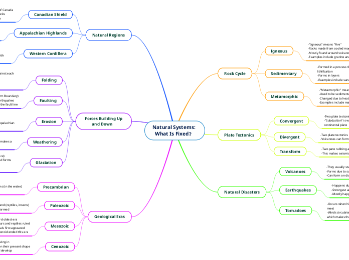
Rock Cycle
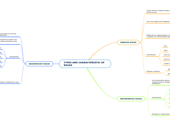
Rock Types
Igneous
Ex. basalt and obsidian
Can see - Tiny holes/spaces, gas bubbles, glasslike surface
Formed from - Magma cooling and hardening
Ex. gneiss and marble
Can see - Ribbon like layers. May have shiny crystals
Formed from - heat and pressure underground
Ex. conglomerate and limestone
Can see - sand, pebbles, and stones. Contains fossils
Formed from - sand, shells, other fragments of material
Landform Region
7 Regions in Canada
Hudson Bay - Artic Lowlands
Lots of Forest, Swampy
Mining
Low, Swampy, Forest, Rolling Landscape
Sand, Silt, and Clay Which Came at The End of The Ice Age and Formed Rock Which Created The Land
Great Lakes - St. Lawrence Lowlands
Flat Land, Rivers
Farming, 50% of Canada's Population Lives Here
Rolling Hills, Flat Plains, Deep River Valleys
erosion from Canadian shield bringing in sediments to the area. and glaciers carried sand, gravel, soil to the area
Interior Plains
Flat
Human Activity
Farming, Transportation, Fishing, Boating, Hiking, Skiing
Flat, Rolling Hills, Wide River Valleys
Formed By
Rocks under Canadian shield getting damaged
Innuitian Mountains
Snowy, Icy, Extremely Cold
Remote (No Human Activity)
Mountainous Measuring 2500 M, Bumpy, Barren (No Trees/Vegetation) - Because its to Cold
North American Plate Moving Forward
Appalachian Mountains
Eroded (Slowly Damaged Rock or Land
Boating, Fishing, Farming
Sedimentary
Rounded, Large Hills, Long Bays, Deep Harbors, Many Wide Valleys
Layers of Sedimentary Rock Uplifting and Folding After North American Plate Collided with European and North African Plate
Canadian Shield
Nature
Mining, Farming, Fishing, Camping
Rock Type
Metamorphic
Rounded Hills of Rock
Magma and Molten Rock Rose to Surface as Volcano
Western Cordillera
Descriptive Words
Glaciers, Inlet (Narrow area of water)
Human Activities
Farming, Mining, Whale Watching, Tourism
Mostly Sedimentary
Landforms
Coast Mountains, Interior Plateau, eastern mountains
Formed by
North American Plate Collision With Pacific Plate
Glaciation
What Force Turns Fallen Snow to Ice
Compacting
How do Glaciers Change Landforms?
Continental Glaciers Smooth out the Land by Eroding High Points and Filling in Low Points
Alpine Glaciers Sharpen Upper Portion of Mountains (Give Them a Rugged Appearance) and Create Broad U-Shaped Valleys
Press Down on Land - Now Rebounding About 1-2 Cm Per Century
When do Glaciers Change Size?
Become Smaller When the Rate of Melt > Accumulation (Retreating)
Become Larger When the Rate of Accumulation > Melt (Advancing)
How do Glaciers Move?
b. Continental Glaciers
Spread Outward From the Centre
Move Under Their Own Weight
a. Alpine Glaciers
Move a Few Centimetres Per Day
Move Down Valleys From High Elevations to Low Elevations Due to Gravity
How is Glacial Ice Different From Regular Ice?
It is Less Polluted (Because it Was Formed a Long Time Ago
It is Denser
It is Formed Differently
How Do Glaciers Form?
Weight of Snow Causes Bottom Layers to Turn to Ice
Snow Accumulates-Hundreds of Metres Thick
Geologic History
The 4 Eras
Cenozoic Era
Hasn't Ended Yet (2% of time, so far)
65 Million Yrs Ago
Mammals, fish, and Plants
4. Appalachians and Canadian Shield Rounded
Caused by erosion
3. glaciers scrap and gouge land
2. Rockies Formed by Folding, Faulting, Volcanos
1. Coast Mountains Uplifted
Mesozoic Era
Lasted 180 Million Yrs (4% of time)
245 Million Yes Ago
Plants, dinosaurs, Birds, Small Sea Creatures
Appalachians eroded
2. Earth Folds Forming Rocky Mountains
Caused By Tectonic Forces
1. North American Plate Collided with Pacific Plate
Formed Coast Range Mountains
Cooled to Granite
Caused Magma to Raise to Top of North American Plate
Paleozoic Era
Lasted 325 million Yrs (7% of time)
570 Million Yrs Ago
Shell's , Other Simple Things, More Advanced Things, Plants, Trees, Fish, Insects, Amphibians
Changes to Land
1. Collision of Pangaea Caused Eastern Part of North America to Crumble and fold to Create Appalachian Mountains
Precambrian Era
lasted 4 billion yrs (87% of time)
4.6 billion yes ago
Living Things
Fossils, Algae, Some More Complexed Organisms
Changes to Land
3. Contains Mostly Igneous and Metamorphic Rock. Some Sedimentary
2. New Land and Oceans
1. New Mountains Formed
Tectonic Plates
Continental Drift
The Theory Discovered by John Tuzo Wilson That all Continents were once attached as one Super Continent (Pangaea) and drifted into separate positions Later.
4 Proofs
Ice
Evidence of Past Glaciers in Warm Places Today. Which Means Continents Used to be Closer to the Poles
Mountains
Same Age & Structure of Mountains in Eastern Canada (Appalachians) & Western Europe (Caledonians)
Fossils
Same Land Animals & Plants in South America & South Africa
Jigsaw Fit
Continents Fit Together Like Puzzle
Boundaries of Plates
Transform
Plates Slide Past Eachother
Ridge Axis
Plates are diverging and new ocean floor is generated
Subduction Zone
Plates converge and One Plate Dives Under the Leading Edge of its Neighbour
mainly continental crust: Eurasia, mainly oceanic crust: pacific
ex. large plates: north american small plates cocos plate
plate tectonics helped shape the earth
Range from 20 km thick (pacific) to 100 km thick (eurasian)
2 Types - Oceanic and Continental
move by convection currents
(magma under plates moving)
20 on earth
Earthquakes
Are We Ready
We are not ready
Many of Our buildings and structures would be destroyed if a large enough earthquake hit us.
Caused by shift of tectonic plates
When the plates hit together and one gets pushed down. then eventually gets shot back up causing earthquake
When the plates separate and create new land causing earthquake
When the plates get Slid past each other and grind causing an earthquake
