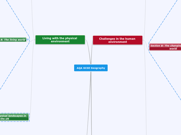
AQA GCSE Geography
Geographical skills
Literacy
Formulate enquiry and argument
Students should demonstrate the ability to:
• identify questions and sequences of enquiry
• write descriptively, analytically and critically
• communicate their ideas effectively
• develop an extended written argument
• draw well-evidenced and informed conclusions about geographical questions and issues.
Use of qualitative and quantitative data
Statistical skills
be able to identify weaknesses in selective statistical presentation of data
describe relationships in bivariate data: sketch trend lines through scatter plots, draw estimated lines of best fit, make predictions, interpolate and extrapolate trends
calculate percentage increase or decrease and understand the use of percentiles
use appropriate measures of central tendency, spread and cumulative frequency (median, mean, range, quartiles and inter quartile range, mode and modal class)
Numerical skills
draw informed conclusions from numerical data
understand and correctly use proportion and ratio, magnitude and frequency
design fieldwork data collection sheets and collect data with an understanding of accuracy, sample size and procedures, control groups and reliability
demonstrate an understanding of number, area and scales, and the quantitative relationships
between units
Graphical skills
interpret and extract information from different types of maps, graphs and charts, including population pyramids, choropleth maps, flow-line maps, dispersion graphs
plot information on graphs when axes and scales are provided
use and understand gradient, contour and value on isoline maps
complete a variety of graphs and maps – choropleth, isoline, dot maps, desire lines, proportional symbols and flow lines
suggest an appropriate form of graphical representation for the data provided
select and construct appropriate graphs and charts to present data, using appropriate scales – line charts, bar charts, pie charts, pictograms, histograms with equal class intervals, divided bar, scattergraphs, and population pyramids
Cartographic skills
Maps in association with photographs
label and annotate diagrams, maps, graphs, sketches and photographs.
draw sketches from photographs
describe human and physical landscapes (landforms, natural vegetation, land-use and
settlement) and geographical phenomena from photographs
photographs: use and interpret ground, aerial and satellite photographs
sketch maps: draw, label, understand and interpret
be able to compare maps
Ordnance Survey maps
infer human activity from map evidence, including tourism.
describe the physical features as they are shown on large scale maps of two of the following
landscapes – coastlines, fluvial and glacial landscapes
interpret cross sections and transects of physical and human landscapes
draw inferences about the physical and human landscape by interpretation of map evidence,
including patterns of relief, drainage, settlement, communication and land-use
identify major relief features on maps and relate cross-sectional drawings to relief features
identify basic landscape features and describe their characteristics from map evidence
numerical and statistical information
use and understand gradient, contour and spot height
use and understand scale, distance and direction – measure straight and curved line
distances using a variety of scales
use and understand coordinates – four and six-figure grid references
use and interpret OS maps at a range of scales, including 1:50 000 and 1:25 000 and other
maps appropriate to the topic
Atlas maps
analyse the inter-relationship between physical and human factors on maps and establish
associations between observed patterns on thematic maps
maps based on global and other scales may be used and students may be asked to identify
and describe significant features of the physical and human landscape on them, eg
population distribution, population movements, transport networks, settlement layout, relief
and drainage
recognise and describe distributions and patterns of both human and physical features
use and understand coordinates – latitude and longitude
Cartographic skills relating to a variety of maps at different scales.
Living with the physical environment
Section C: Physical landscapes in the UK
River landscapes in the UK
Different management strategies can be used to protect river landscapes from the effects of flooding.
An example of a flood management scheme in the UK to show:
• why the scheme was required
• the management strategy
• the social, economic and environmental issues.
The costs and benefits of the following management strategies:
soft engineering – flood warnings and
preparation, flood plain zoning, planting
trees and river restoration
hard engineering – dams and reservoirs,
straightening, embankments, flood relief
channels
June 2013 Reservoir & OS map
Jine 2013 River engineering
The use of hydrographs to show the
relationship between precipitation and discharge.
June 2013 Hydrograph
How physical and human factors affect the
flood risk – precipitation, geology, relief and land use.
Distinctive fluvial landforms result from different physical processes.
An example of a river valley in the UK to identify its major landforms of erosion and deposition.
Characteristics and formation of landforms resulting from deposition – levées, flood plains and estuaries.
Characteristics and formation of landforms
resulting from erosion and deposition – meanders and ox-bow lakes.
Characteristics and formation of landforms
resulting from erosion – interlocking spurs, waterfalls and gorges
June 2015 waterfall
June 2013 River characteristics
The shape of river valleys changes as rivers flow downstream.
Fluvial processes:
deposition – why rivers deposit sediment
transportation – traction, saltation, suspension and solution
June 2013 transport & deposition
erosion – hydraulic action, abrasion, attrition, solution, vertical and lateral erosion
The long profile and changing cross profile of a
river and its valley.
Coastal landscapes in the UK
Different management strategies can be used to protect coastlines from the effects of physical processes.
An example of a coastal management scheme in the UK to show:
• the reasons for management
• the management strategy
• the resulting effects and conflicts.
The costs and benefits of the following
management strategies:
managed retreat – coastal realignment.
soft engineering – beach nourishment and reprofiling, dune regeneration
hard engineering – sea walls, rock armour, gabions and groynes
Distinctive coastal landforms are the result of rock type, structure and physical processes.
An example of a section of coastline in the UK to identify its major landforms of erosion and deposition
Characteristics and formation of landforms
resulting from deposition – beaches, sand dunes, spits and bars.
Characteristics and formation of landforms resulting from erosion – headlands and bays,
cliffs and wave cut platforms, caves, arches and stacks.
How geological structure and rock type influence coastal forms.
The coast is shaped by a number of physical processes.
Coastal processes:
deposition – why sediment is deposited in coastal areas.
transportation – longshore drift
erosion – hydraulic power, abrasion and attrition
mass movement – sliding, slumping and rock falls
weathering processes – mechanical, chemical
Wave types and characteristics.
The UK has a range of diverse landscapes.
An overview of the location of major upland/ lowland areas and river systems.
Section B: The living world
Cold environments
Cold environments are at risk from economic development.
Strategies used to balance the needs of economic development and conservation in cold environments – use of technology, role of governments, international agreements and conservation groups.
The value of cold environments as wilderness
areas and why these fragile environmentsshould be protected.
Development of cold environments creates opportunities and challenges.
A case study of a cold environment to illustrate:
• development opportunities in cold
environments: mineral extraction, energy, fishing and tourism
• challenges of developing cold environments: extreme temperature, inaccessibility, provision of buildings and infrastructure.
Cold environments (polar and tundra) have a range of distinctive characteristics.
How plants and animals adapt to the physical conditions.
The interdependence of climate, permafrost, soils, plants, animals and people.
The physical characteristics of a cold environment.
Tropical rainforests
Tropical rainforests need to be managed to be sustainable.
Strategies used to manage the rainforest sustainably – selective logging and replanting, conservation and education, ecotourism and international agreements about the use of tropical hardwoods, debt reduction.
Value of tropical rainforests to people and the
environment.
Deforestation has economic and environmental impacts.
A case study of a tropical rainforest to
illustrate:
• causes of deforestation – subsistence and
commercial farming, logging, road building, mineral extraction, energy development, settlement, population growth
• impacts of deforestation – economic development, soil erosion, contribution to climate change.
Changing rates of deforestation.
Tropical rainforest ecosystems have a range of distinctive characteristics.
Issues related to biodiversity.
How plants and animals adapt to the physical
conditions.
The interdependence of climate, water, soils,
plants, animals and people.
The physical characteristics of a tropical
rainforest.
Ecosystems
Ecosystems exist at a range of scales and
involve the interaction between biotic and
abiotic components
An overview of the distribution and
characteristics of large scale natural global
ecosystems.
The balance between components. The impact
on the ecosystem of changing one component.
An example of a small scale UK ecosystem to
illustrate the concept of interrelationships within a natural system, an understanding of producers, consumers, decomposers, food
chain, food web and nutrient cycling.
Section A: The challenge of natural hazards
Climate change
Managing climate change involves both mitigation (reducing causes) and adaptation (responding to change)
adaptation – change in agricultural
systems, managing water supply,
reducing risk from rising sea levels.
mitigation – alternative energy production,
carbon capture, planting trees,
international agreements
Climate change is the result of natural and
human factors, and has a range of effects.
Overview of the effects of climate change on
people and the environment.
Possible causes of climate change:
human factors – use of fossil fuels,
agriculture and deforestation
natural factors – orbital changes, volcanic
activity and solar output
Evidence for climate change from the beginning
of the Quaternary period to the present day.
Weather hazards
Extreme weather events in the UK have impacts on human activity.
Evidence that weather is becoming more
extreme in the UK.
2013 UK extreme weather management
An example of a recent extreme weather event in the UK to illustrate:
• causes
• social, economic and environmental impacts
• how management strategies can reduce risk.
The UK is affected by a number of weather hazards.
An overview of types of weather hazard
experienced in the UK.
June 2015 UK weather
Tropical storms have significant effects on people and the environment.
How monitoring, prediction, protection and
planning can reduce the effects of tropical
storms.
Use a named example of a tropical storm to
show its effects and responses.
Immediate and long-term responses to tropical
storms.
Primary and secondary effects of tropical
storms.
June 2015 effects of tropical revolving storms
Tropical storms (hurricanes, cyclones, typhoons) develop as a result of particular physical conditions.
How climate change might affect the
distribution, frequency and intensity of tropical
storms.
The structure and features of a tropical storm
Causes of tropical storms and the sequence of
their formation and development.
An understanding of the relationship between
tropical storms and general atmospheric
circulation.
Global atmospheric circulation helps to
determine patterns of weather and climate.
Global distribution of tropical storms
(hurricanes, cyclones, typhoons).
Tectonic hazards
Management can reduce the effects of a
tectonic hazard.
- Reasons why people continue to live in areas at risk from a tectonic hazard.
- How monitoring, prediction, protection and planning can reduce the risks from a tectonic hazard.
How monitoring, prediction, protection and
planning can reduce the risks from a tectonic hazard.
Reasons why people continue to live in areas at
risk from a tectonic hazard.
The effects of, and responses to, a tectonic
hazard vary between areas of contrasting levels of wealth.
- Primary and secondary effects of a tectonic hazard.
- Immediate and long-term responses to a tectonic hazard.
- Use named examples to show how the effects and responses to a tectonic hazard vary between two areas of contrasting levels of wealth.
Use named examples to show how the effects and responses to a tectonic hazard vary between two areas of contrasting levels of wealth.
Immediate and long-term responses to a
tectonic hazard.
Primary and secondary effects of a tectonic
hazard.
volcano
earthquake
Earthquakes and volcanic eruptions are the
result of physical processes
- Plate tectonics theory.
- Global distribution of earthquakes and volcanic eruptions and their relationship to plate margins.
- Physical processes taking place at different types of plate margin (constructive, destructive and conservative) that lead to earthquakes and volcanic activity
Physical processes taking place at different
types of plate margin (constructive, destructive
and conservative) that lead to earthquakes and
volcanic activity
Global distribution of earthquakes and volcanic
eruptions and their relationship to plate
margins
Plate tectonics theory
Natural hazards
Natural hazards pose major risks to people and property.
- Definition of a natural hazard.
- Types of natural hazard.
- Factors affecting hazard risk.
Factors affecting hazard risk
Types of natural hazard
Definition of a natural hazard.
Geographical applications
Section B: Fieldwork
questions based on students’ individual enquiry work. For these questions students will have to identify the titles of their individual enquiries.
AQA GCSE Geography Paper 3 - SAM Fieldwork question part 2 - "own fieldwork"
questions based on the use of fieldwork materials from an unfamiliar context
Sample Assessment Material: fieldwork questions - "unfamiliar context"
Section A: Issue evaluation
ADVANCED INFORMATION BOOKLET [AIB]
AIB 2019
Challenges in the human environment
Section C: The challenge of resource management
Resource management
Different strategies can be used to increase
energy supply
Moving towards a sustainable resource future
an example of a local renewable energyscheme in an LIC or NEE to provide sustainable supplies of energy.
individual energy use and carbon footprints. Energy conservation: designing homes, workplaces and transport for sustainability, demand reduction, use of technology to increase efficiency in the use of fossil fuels
Overview of strategies to increase energy supply
an example to show how the extraction of a fossil fuel has both advantages and disadvantages.
renewable (biomass, wind, hydro, tidal, geothermal, wave and solar) and nonrenewable (fossil fuels and nuclear power) sources of energy
Demand for energy resources is rising globally
but supply can be insecure, which may lead to
conflict.
Impacts of energy insecurity
exploration of difficult and environmentally sensitive areas, economic and environmental costs, food production, industrial output, potential for conflict where demand exceeds supply
Areas of surplus (security) and deficit (insecurity)
factors affecting energy supply: physical factors, cost of exploitation and production, technology and political factors
reasons for increasing energy consumption: economic development, rising population, technology
• global distribution of energy consumption and supply
The changing demand and provision of resources in the UK create opportunities and challenges.
Energy
economic and environmental issues
associated with exploitation of energy
sources.
reduced domestic supplies of coal, gas
and oil
the changing energy mix – reliance on
fossil fuels, growing significance of
renewables
Water
the need for transfer to maintain supplies.
matching supply and demand – areas of
deficit and surplus
June 2015 UK water deficit
water quality and pollution management
the changing demand for water
Food
the trend towards agribusiness.
larger carbon footprints due to the
increasing number of ‘food miles’
travelled, and moves towards local
sourcing of food
the growing demand for high-value food
exports from low income countries and
all-year demand for seasonal food and
organic produce
An overview of resources in relation to the UK
Food, water and energy are fundamental to
human development.
An overview of global inequalities in the supply and consumption of resources.
The significance of food, water and energy to economic and social well-being.
Section B: The changing economic world
Major changes in the economy of the UK have
affected, and will continue to affect, employment
patterns and regional growth.
Economic futures in the UK
the place of the UK in the wider world.
Links through trade, culture, transport, and electronic communication. Economic and political links: the European Union (EU) and Commonwealth.
the north–south divide. Strategies used in
an attempt to resolve regional difference
improvements and new developments in
road and rail infrastructure, port and airport capacity
social and economic changes in the rural landscape in one area of population growth and one area of population decline
impacts of industry on the physical
environment. An example of how modern
industrial development can be more
environmentally sustainable
moving towards a post-industrial
economy: development of information
technology, service industries, finance,
research, science and business parks
causes of economic change: deindustrialisation and decline of traditional industrial base, globalisation and
government policies
Various strategies exist for reducing the global development gap
An example of how the growth of tourism in an LIC or NEE helps to reduce the development gap.
An overview of the strategies used to reduce
the development gap: investment, industrial development and tourism, aid, using intermediate technology, fairtrade, debt relief, microfinance loans.
Some LICs and NEEs are experiencing rapid economic development which leads to significant social, environmental and cultural change.
A case study of one LIC or NEE to illustrate:
• the location and importance of the country, regionally and globally
• the wider political, social, cultural and environmental context within which the country is placed
• the changing industrial structure. The balance between different sectors of the economy. How manufacturing industry can stimulate economic development
• the role of transnational corporations (TNCs) in relation to industrial development. Advantages and disadvantages of TNC(s) to the host country
• the changing political and trading relationships with the wider world
• international aid: types of aid, impacts of aid on the receiving country
• the environmental impacts of economic development
• the effects of economic development on quality of life for the population.
There are global variations in economic development and quality of life.
Consequences of uneven development: disparities in wealth and health, international migration.
Causes of uneven development: physical,
economic and historical
Link between stages of the Demographic
Transition Model and the level of development.
Limitations of economic and social measures.
Different economic and social measures of development: gross national income (GNI) per
head, birth and death rates, infant mortality, life
expectancy, people per doctor, literacy rates,
access to safe water, Human Development Index (HDI)
Different ways of classifying parts of the world according to their level of economic development and quality of life.
Section A: Urban issues and challenges
Urban sustainability requires management of resources and transport.
How urban transport strategies are used to
reduce traffic congestion.
Features of sustainable urban living:
• water and energy conservation
• waste recycling
• creating green space.
2013 sustainable strategies
Urban change in cities in the UK leads to a variety of social, economic and environmental opportunities and challenges.
An example of an urban regeneration project to show:
• reasons why the area neededregeneration
• the main features of the project
A case study of a major city in the UK to
illustrate:
• the location and importance of the city in the UK and the wider world
• impacts of national and international
migration on the growth and character of the city
• how urban change has created opportunities:
• social and economic: cultural mix, recreation and entertainment, employment, integrated transport systems
• environmental: urban greening
• how urban change has created challenges:
• social and economic: urban deprivation, inequalities in housing, education, health and employment
• environmental: dereliction, building on brownfield and greenfield sites, waste disposal
• the impact of urban sprawl on the
rural–urban fringe, and the growth of commuter settlements.
June 2013 Brownfield site
Overview of the distribution of population and
the major cities in the UK
Urban growth creates opportunities and challenges for cities in LICs and NEEs.
A case study of a major city in an LIC or NEE to illustrate:
• the location and importance of the city, regionally, nationally and internationally
• causes of growth: natural increase and migration
• how urban growth has created opportunities:
• social: access to services – health and education; access to resources – water supply, energy
• economic: how urban industrial areas can be a stimulus for economic development
• how urban growth has created challenges:
• managing urban growth – slums, squatter settlements
• providing clean water, sanitation systems and energy
• providing access to services – health and education
• reducing unemployment and crime
• managing environmental issues – waste disposal, air and water pollution, traffic congestion.
An example of how urban planning is improving the quality of life for the urban poor.
A growing percentage of the world’s population lives in urban areas.
The emergence of megacities.
Factors affecting the rate of urbanisation –
migration (push–pull theory), natural increase
Urban trends in different parts of the world
including HICs and LICs.
The global pattern of urban change
